


We are excited in our expansion and integration of GIS analytics to enhance and support project outcomes. With ongoing improvements to open data accessibility through key Government initiatives and platforms (TfNSW Open Data Hub, Data.NSW, ABS, Elastic Beanstalk), there are significant opportunities to add value for projects of all scales.
Our approach to GIS is to provide an integrated analysis that aims to understand key relationships and their impacts and can serve as a cross-validation tool for modelling outcomes.
GIS helps to visualise geographic relationships that impact infrastructure, to determine capacity and demand, to improve operations and safety, environmental impacts and other concerns related to transportation. Some applications of GIS in Transport that we currently offer are discussed below; we look forward to expanding our capabilities in this field to provide truly integrated transport outcomes.
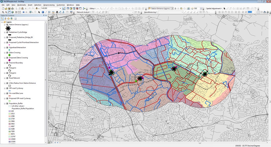
GIS in Transport Planning
Map visualisation and data integration are the most important objectives of using GIS. GIS offer transport planners a platform for storing and analysing data to identify potential planning problems, and to address the issue by integrating GIS to land uses, population densities, travel behaviour, etc. GIS maps are efficient, effective and economical as compared to conventional applications and are being used to develop transportation policy and planning.
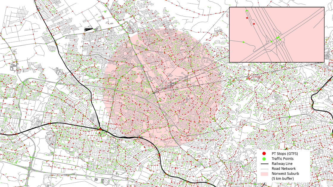
GIS in Transport Modelling
Topographical data in the GIS platform can be converted into functional road models for large-scale traffic simulation. GIS helps to geocode road networks as vector layers with set of attributes which helps to organise and spatially visualise road network based on their characteristics. Road network layer database from GIS can be extrapolated to provide road features for traffic simulation like highways, intersections, smoothly connected ramps and overpasses.
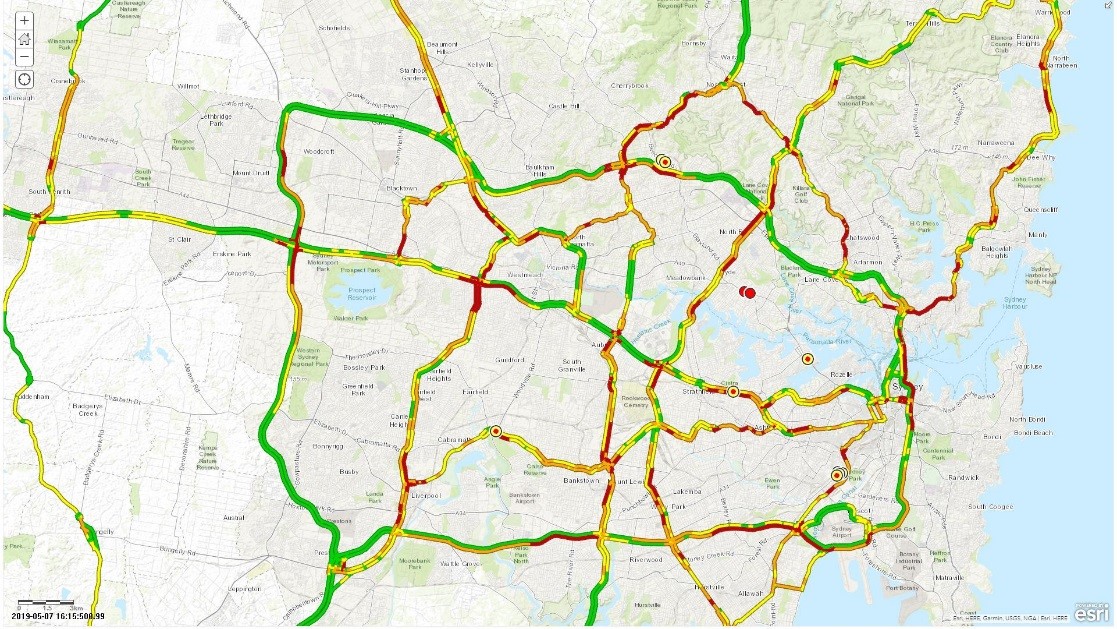
GIS in Data Analytics
Spatial data can harness accurate, real-time and comprehensive information to inform transport and infrastructure use. GIS delivers powerful spatial analytics to process data from mobile phone GPS, public transport usage and roadside sensor to create forecasts based on historical data, to support real-time route suggestions, to build long-term visualisation tools for use by policymakers and traffic planners, regulatory or revenue collection applications and active traffic network management.
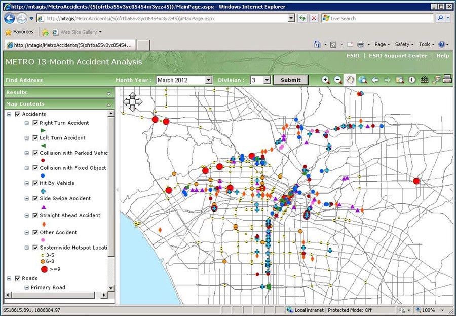
GIS in Road Safety
Applications in road safety include analysis of crash data, to share crash risks, to report pedestrian safety issues and to locate high-risk roadways. GIS can analyse historical accident data allowing the authorities to find patterns and identify the hot spots of road accidents. GIS is a key tool in accident analysis and to minimise the number of accidents on roads by identifying the accident locations and providing remedial measures.
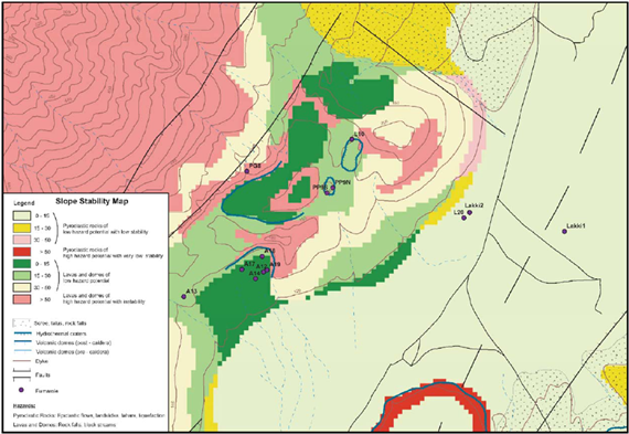
GIS in Environment
GIS helps to assess, monitor and mitigate the environmental problems and is useful in preparing Environmental Impact Statements (EIS) for transport infrastructure projects to contain relevant information on risks (areas of high risk), hazards (highly prone areas) and areas to be safeguarded. The environment impact analysis can be carried out efficiently by integrating various GIS layers such as slopes, aspects, and vegetation, to determine various environmental parameters.
GIS in Transport Inventory Management
GIS to know where transport inventory is and information about them. The process of infrastructure management using GIS involves identifying the assets, mapping them and assessing the condition. A collection of maps are used to inventory street intersections, street signs, traffic signals, streetlights, railroad crossings, bridges, sidewalks, cycling infrastructure, pavement markings, guardrails, calming devices, street furniture, street trees, and other public rights of way assets.